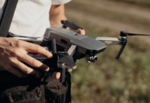
According to a recent study from Global Data, drone technology has improved a wide variety of mining operations. It is poised to continue influencing key market patterns.
Drones are being used in various mining applications, including drilling, surveying, and mapping, as well as ensuring safety and improving efficiency.
Unmanned aerial vehicles (UAVs) have increased in prominence in the mining industry in recent years. An aerial service company described the following core factors affecting drone uses in the mining industry:
Inspection and Monitoring
Mining is one of the most dangerous industries for workers, including those involved in deep underground operations. Rock slides, highly humid temperatures, gas leakage, dust storms, and flooding are also potential dangers for staff.
As a result, mining firms have used drones to track and search deep shafts in underground mines. Drones are now being used to test mining machines. This costly and time-consuming operation necessitates a highly trained workforce. Furthermore, the limited period allocated for inspection could affect the accuracy of data gathered manually.
Automatic Mapping and Surveying
In most cases, surveying and mapping mineral landscapes take a long time. A mine will save about 90% of the cost per hour by using drones and a drone pilot instead of a piloted aircraft and capture unlimited aerial data – including fine measurements by simultaneously taking high-end Ortho-images.
Control of Stockpiles
The extreme height and area of stockpiles, which appear to shift constantly, is one of the most challenging obstacles any mining company faces when handling them. Mining companies may use high end drones to create aerial landscape models of their inventory. Furthermore, using drones regularly may help businesses keep track of stockpile movement.
Optimization of Haulage Roads
The productivity of mining operations is heavily influenced by the haul road network. Haul road conditions must be continuously tracked to ensure reliable and uniform transit. Drones can help in this method by gathering a vast volume of aerial data. More specifically, covering larger fields, engineers can then use planning, modeling, building, and maintenance.
Management of Tailings Dams
Drones may be used to measure tailings dams, reducing the possibility of manual surveying. When drones are present, there is no need for manual interference in the vicinity of the landfill. Mining companies can protect the tailings dam’s structural stability, design extension and prevent loss by analyzing the digital network’s collected data.
The Flow of Water And Sand
Drones in mining may also help prevent activities from being disrupted by unregulated or unwanted water or sediment movement. The automated elevation maps generated by drone imagery can be used to model flow and tailings pond operations. Since drones can fly constantly, you can build a visual archive of the site over time and monitor progress weekly or monthly, which you can save for future operations or regulatory audits.
Though still in their infancy, drones are expected to significantly affect the mining industry in the coming years in terms of production, expense, and performance.


